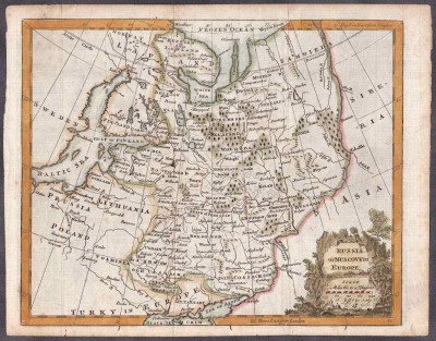
“Russia or Moscovy in Europe”
Антикварная гравюра на меди середины XVIII века с акварельной раскраской эпохи, размер листа 25,5х20 см, в хорошей сохранности. Бумага верже с водными знаками в виде характерной "решетки" и символа.
Томас Джефрис (Thomas Jefferys, 1695 - November 20, 1771) – английский картограф, гравер, географ короля Георга III, ведущий картограф в Англии своего времени. Создавал гравированные карты для правительства и официальных лиц, а также гравировал и печатал карты и атласы. В начале карьеры в качестве «географа принца Уэльского» создал «План всех строений, уничтоженных и поврежденных Великим Пожаром в 1748 году» (A Plan of all the Houses, destroyed & damaged by the Great Fire, which begun in Exchange Alley Cornhill, on Friday March 25, 1748), совместно с Томасом Китчином (Thomas Kitchin) издал Малый Английский Атлас, а также гравировал планы городов Средней Англии. В 1755 г. Джеффрис издал Карту наиболее населенных частей Новой Англии на основании исследований Джона Грина, в 1768 г. картограф в сотрудничестве с Робертом Сайером выпустил «Общую Топографию Северной Америки и Вест-Индии» (A General Topography of North America and the West Indies). В 1765-70-х гг.по заказам Джеффрис создал большие подробные карты английских провинций. После кончины Джеффириса, в 1775 г. коллекцию его карт издал Р. Сайер под названием «Атлас Америки» и «Атлас Вест-Индии».
Mapmaker: Thomas Jefferys (1695 - November 20, 1771) was one of the most prominent and prolific map publishers and engravers of his day. Jefferys was born in Birmingham and was apprenticed to the engraver Emmanuel Bowen in 1735. Later, in the 1740s he engraved several maps for the popular periodical Gentleman's Magazine. Around 1740 Jefferys was finally able to go into business for himself and in 1746 received an appointment as 'Geographer to Fredrick, Prince of Wales,' which shortly after translated to the position of 'Royal Cartographer to King George III.' Jefferys initially specialized in compiling and re-engraving the works of earlier cartographers into more coherent cartographic wholes. Later, while not salaried position, Jefferys' appointment as 'Royal Cartographer' guaranteed preferential access to the most up to date cartographic material available, allowing him to produce new and updated charts of exceptional accuracy. He his best known for his maps of the Americas, particularly the posthumously published 1775 American Atlas, which included some of the finest and most important late colonial era maps of America ever made. Despite his prolific publishing history, royal appointments, and international publishing fame, Jefferys lived most of his life in dire economic straits. He was bailed out of bankruptcy by Robert Sayer during the production of the American Atlas. In the end, Jefferys died suddenly with very little to his name. Nonetheless, his cartographic legacy survived, and even after his death in 1771, many of his important maps continued to be published and republished by Sayer and Bennet, Conrad Lotter, Georges Louis Le Rouge, Laurie and Whittle, and others. Many attribute some of Jefferys best maps to the colorful and criminally inclined Irish cartographic genius Braddock Mead (John Green, c. 1688 - 1757), who is considered the 'secret behind Jefferys.' Jefferys was succeeded by his son, also Thomas, who had little success as a cartographer and eventually partnered with, then sold his stock and plates to William Faden - Jefferys' true heir.


